Land demarcation in Dubai: steps, documents and fees
Find the authority for your plot, choose initial, repeat or final demarcation, and check DDA's published documents, AED 400 fee and separate levies.

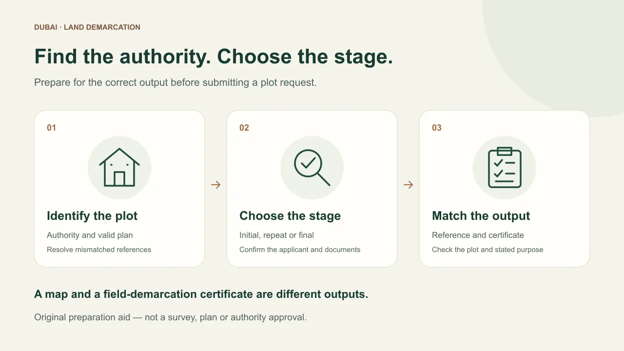
Land demarcation in Dubai identifies plot boundaries on the ground. Start by confirming the authority for your plot and the stage of work: the Dubai Development Authority distinguishes initial demarcation, re-demarcation and final demarcation. Its public service card, checked 9 November 2026, publishes a fee of AED 400 per plot, separate AED 10 knowledge and AED 10 innovation fees per transaction, and an estimated five working days. Those figures describe DDA's service; first confirm that this is your plot's route.
Which authority should I use?
Ask the owner or appointed consultant to confirm the authority using the plot and building-permit records. A Dubai address alone is insufficient to choose an application portal.
| Your starting point | Official route to check | Question before applying |
|---|---|---|
| Plot handled through DDA | DDA Land Demarcation card → Zoning e-Services | Which stage and applicant role apply to this project? |
| Dubai Municipality project | Municipality services directory → Land Demarcation | What are the current documents, payment and site-access requirements? |
| You need a registered property map | DLD Property Map Request | Is an e-map sufficient, or does the recipient also require field demarcation? |
| Authority is unclear | Plot/permit issuer and your consultant | Which authority must accept the output for this purpose? |
The Municipality directory describes demarcation for soil testing, grid levelling and replacing lost points (checked 9 November 2026). The detailed service card for code 3697 wasn’t accessible. Ask the Municipality for its current documents, fees and processing time; DDA’s figures don’t cover that route.
Initial, repeat or final demarcation?
Use this stage guide when discussing the application with your consultant. It summarises the DDA card, checked 9 November 2026:
| DDA stage | Purpose and output | Listed requester | Document preparation from the card |
|---|---|---|---|
| Land Demarcation | Mark corners before construction; approved demarcation certificate | Plot owner or consultant | Valid site plan; owner's consultant appointment letter |
| Land Re-Demarcation | Check limits during construction; approved re-demarcation certificate | Contractor | Valid site plan; confirm current application attachments |
| Final Land Demarcation | Check boundaries/structures against as-built survey before building completion certification | Contractor | Valid site plan; as-built drawing in A3 hard copy and AutoCAD |
The card also names a request form for service-centre applications; its listed request channel is online. Confirm which route and attachment list apply rather than inferring a walk-in route from the form note. Have the plot and permit references ready when asking about applicant authority.
If someone says “we already have demarcation”, ask which stage, which plot and which issued record they mean. Save the answer with the certificate rather than treating an application receipt as the final output.
How do you apply through DDA?
The published sequence is: enter Zoning e-Services, choose the relevant project and application, complete fields and upload documents, submit, pay and await feedback. The card requires a valid site plan. It lists the owner's consultant appointment letter for initial demarcation and an as-built survey drawing in A3 hard copy and AutoCAD format for final demarcation; its request-form note refers to customer-service-centre applications. Source: DDA service card, checked 9 November 2026.
Before using that sequence, prepare your own working file:
- Identify the parcel. Keep the plot reference and the plan version together. If documents use different identifiers, ask the consultant to explain the relationship.
- Agree the output. Record whether the recipient needs an initial, repeat or final certificate. Ask what the output must demonstrate for your next task.
- Confirm responsibility. Name the person preparing the application, the authorised applicant and the site contact. Ask who will answer requests for more information.
- Arrange practical access. Ask how the site team should prepare access and protect any existing markers. Obtain instructions from the relevant authority or consultant rather than improvising survey work.
- Keep the reference. Retain the submission, itemised payment record, feedback and issued output together. Follow up against the actual reference if the estimate passes.
If land use is granted under a Musataha agreement, also ask who may appoint the consultant and commission the work under that agreement.
How much should I budget?
For one plot in one DDA transaction, the published components above add to AED 420. That subtotal covers the listed authority components, before separately commissioned work. Do not assume the transaction levies multiply per plot in a multi-plot application; ask for the actual itemisation.
| One-plot, one-transaction illustration | Amount | Basis on DDA's card |
|---|---|---|
| Base service | AED 400 | Per plot |
| Knowledge Dirham | AED 10 | Per transaction |
| Innovation Dirham | AED 10 | Per transaction |
| Arithmetic subtotal | AED 420 | Excludes any separately commissioned preparation |
Keep a separate line for each quoted item:
| Budget line | What to request |
|---|---|
| Authority fee | Service name, plot count and transaction reference |
| Consultant or survey preparation | Written scope, deliverables and amount, if separately charged |
| Repeat work | Reason, new application needed and applicable fee |
| Unexplained addition | Publisher, basis and whether already included elsewhere |
Get separate quotes for consultant work, repeat applications and any applicable tax. Leave missing amounts open. The five-working-day figure is DDA's estimate for its service, not a guaranteed date for your construction programme.
Do you need a map or boundaries marked on site?
DLD's Property Map Request, checked 9 November 2026, issues an e-map for registered property. A map is a different output from marking boundaries on site. Ask the receiving authority which output it needs before paying for a map.
When comparing land and building figures, use our BUA and plot-area explanation. A constructed-area number in a brochure does not tell you where to place a boundary marker. A property valuation certificate serves another purpose again: establish the requested document before commissioning it.
What if the fence or drawing does not match?
Hypothetical example: an owner has a plan, a contractor's sketch and an existing fence in different apparent positions. Put the documents and dated observations together and ask the appointed consultant which current authority record and survey should resolve the mismatch. Do not convert a visual impression into a statement that a neighbour has encroached, or move markers on the strength of this article.
For contractual questions, keep the sale agreement and its annexes with the technical file. Ask the consultant to explain any boundary difference before arranging alterations.
A Makani number identifies an entrance meeting point; it does not replace the plot/site-plan references needed for a boundary task. Ask the survey authority for the accepted identifiers.
If the parcel comes from an approved land award, use the Dubai land-grant registration steps to identify the registration file and required grant map. Boundary demarcation does not itself record or award a grant.
For a valuation document you already hold, use the valuation certificate checking steps to separate property details, verification and recipient requirements.
FAQ
Is AED 420 the demarcation price everywhere in Dubai?
No. It is the one-plot, one-transaction arithmetic from the quoted DDA components. The authority for your land and any separately commissioned work need their own confirmation.
Can the owner apply for final demarcation under DDA's card?
The checked card lists the contractor for final and repeat demarcation. Confirm the authorised applicant for your actual project before preparing the submission.
Does an e-map replace a demarcation certificate?
The checked services describe different outputs. Ask the authority or recipient which one is needed for the task; obtaining a map does not establish that field demarcation took place.
What should I do if the portal gives no usable service details?
Return to the official directory and ask the authority for the current card using the service name and plot reference. Keep the unanswered fees and requirements visible until confirmed.
Sources
- Dubai Development Authority — Land Demarcation · 2026-11-09
- Dubai Municipality — services directory · 2026-11-09
- Dubai Land Department — Property Map Request · 2026-11-09
Sources
- Dubai Development Authority — Land Demarcation — https://dda.gov.ae/en/planning-development/additional-services/land-demarcation · checked
Opened public card distinguishes initial, repeat and final demarcation, applicants, documents, valid site plan, online steps, AED 400 per plot plus AED 10 knowledge and AED 10 innovation per transaction, and five-working-day estimate. DDA route only; no plot eligibility or actual application checked.
- Dubai Municipality — services directory — https://www.dm.gov.ae/dubai-municipality-services/ · checked
Opened directory lists Land Demarcation for soil testing, grid levelling and replacement of lost points. Linked service 3697 redirected to the portal shell; current detailed Municipality fees, documents and turnaround not established.
- Dubai Land Department — Property Map Request — https://dubailand.gov.ae/en/eservices/property-map-request/ · checked
Opened card describes issuance of an e-map for registered property. Used to distinguish map issuance from field demarcation; map fees are not quoted as demarcation fees.
More in Due diligence
Start here: Due diligence
- Land grant registration in Dubai: documents and steps
- Property valuation certificate Dubai: how to apply
- A2A form Dubai — what to check before signing
- Anti-trust law Dubai: UAE competition rules for investors
- BUA meaning in real estate: check your Dubai floor plan
- Al Sa’fat Dubai green building system: what to check
- No objection certificate Dubai: property NOC guide
- Property valuation certificate Dubai: check and use it
- How to sell property in Dubai without an agent
- COVID impact on Dubai real estate: what the data says
- Sharia law in Dubai for property: inheritance in 2026
- Musataha agreement Dubai: rights, term and document checks
- RVS Dubai: real estate complaints and tracking (2026)
- Property purchase agreement Dubai: SPA buyer guide
- Waiver registration in Ras Al Khaimah: documents and fees